By: Gaynor
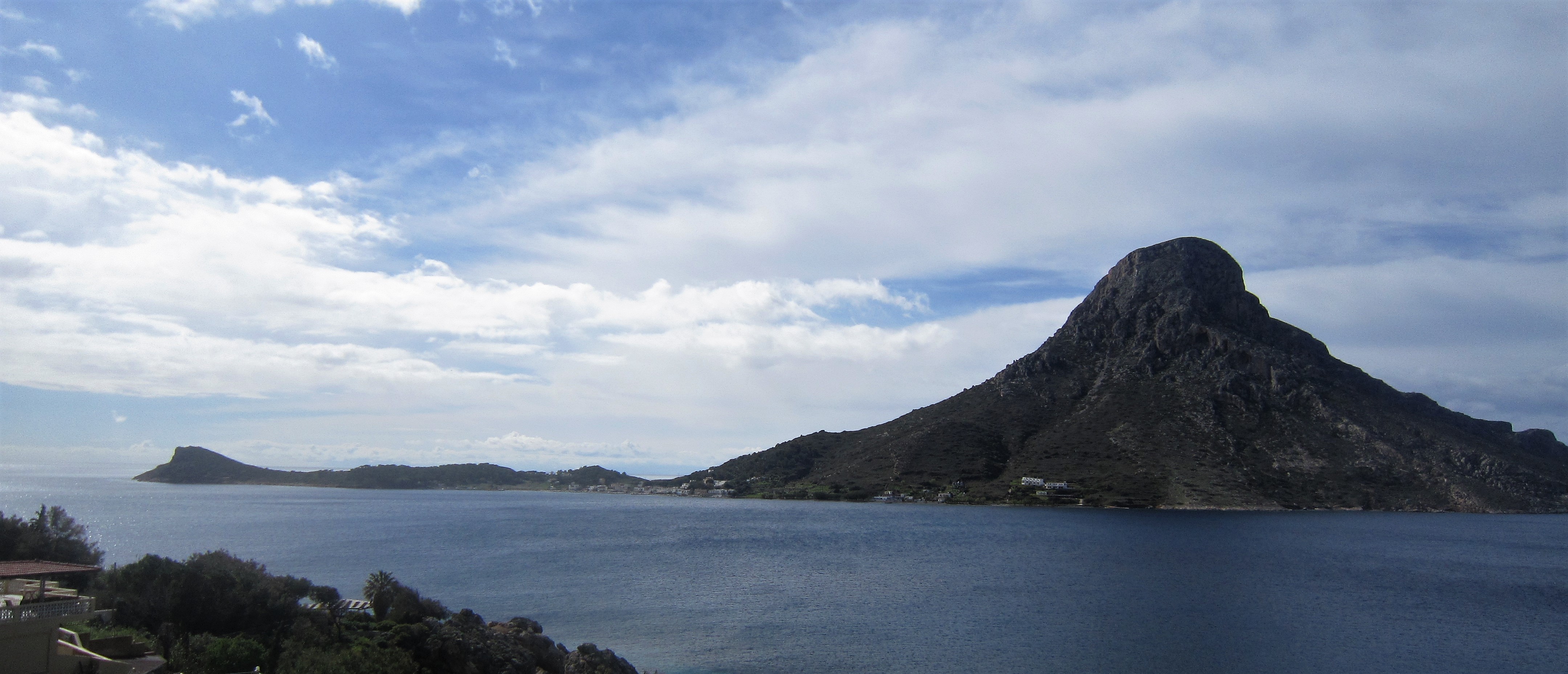
After nearly 10 days of watching beautiful sunsets over the island of Telendos, just off the coast of Kalymnos, we decided it was time to investigate further. Part of the long distance Kalymnos Trail circles around the island in a 10km sector that takes the walker past some of the major climbing crags as well as a Byzantine chapel and ancient village. Along with our friends Mark and Penny who have joined us for a couple of weeks, we decided this walk would be a good rest day activity after 5 consecutive days of climbing.
Our allotted day dawned bright and breezy and we caught the small ferry for the 15 minute ride across to the island, arriving in it’s small harbour surrounded by a handful of houses and cafes. Our path would take us through the delightfully named Princess Canyon, which we had been warned could be hard to find. But as soon as we stepped off the boat we saw a signpost, helpfully labelled “Princess Canyon, 1hr20m”. Excellent.
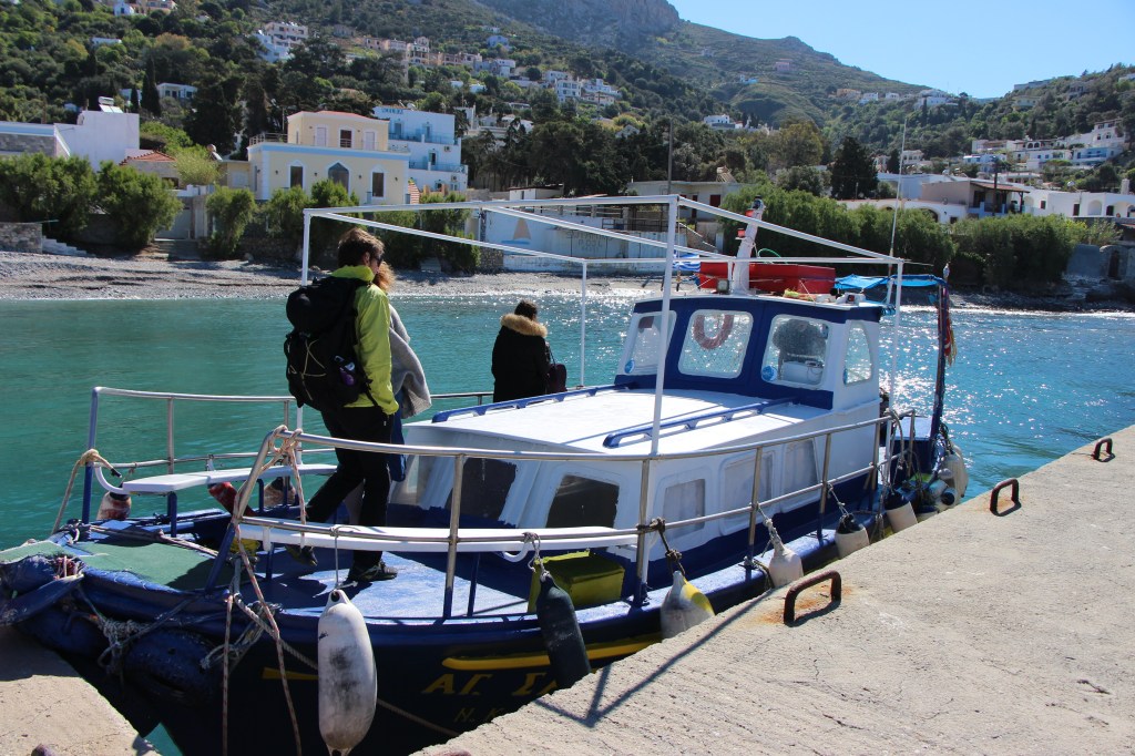
Boarding the little ferry 
Signposts!
So off we set, through some ruins of an early Christian Basilica and up the path through the goat gate. Telendos is dominated by the mountain in the middle, and the map showed the walking route contouring around the southern edge of the mountain to the western tip where it crossed at a lower point before descending down and returning on the northern side. Just after the goat gate we saw a big blue arrow pointing up the hill, away from a nasty looking red scree slope which slipped down into the sea below. We followed the arrow and saw blue dots heading along a vague path in front of us. “Splendid”, we all thought, we have a marked trail.
It is a bit generous to call it a trail, or even a path. It was a thin meandering strip of slightly worn vegetation interspersed with rocks and boulders. Really hard to navigate, the blue dots often disappeared and the going was strenuous and uneven. We were also heading up higher than I had anticipated, and we found ourselves at the base of some of the muti-pitch climbs that ascend the dramatic vertical walls of the mountain. We continued along the base of the mountain cliffs as our map showed Princess Canyon along the same line as the crags, and ultimately all we needed to do was to continue heading west between the sea and the crags. As it turned out, this was not the best plan.
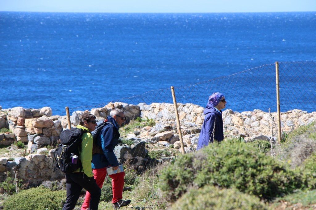
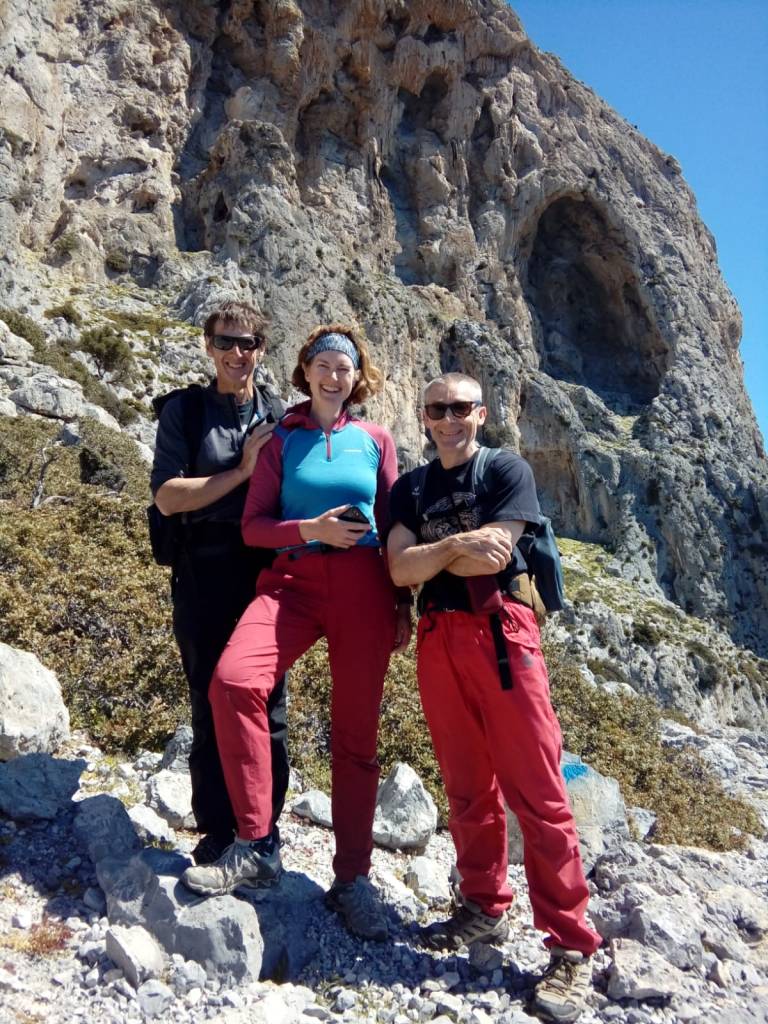
Penny, Mark and Jon heading off from the ruins 
Jon finding the route up the hillside
We painstakingly traversed the hillside, the terrain becoming more and more difficult alternating between scree slopes, and rocks interspersed with incredibly painful gorse bushes that left splinters in our fingers. We had been told that the entrance to Princess Canyon involved a low grade scramble with a rope attached to help with the ascent. And sure enough after a couple of hours of walking we reached a 3m vertical rock wall with a relatively easy scramble up, aided by a rope. So up we went. On the top was a bit of a plateau and then a precipitous path down accompanied by blue dots. We were standing on a ledge, this was not a canyon.
At about this point we were really beginning to question whether we were in the right place, and whether we should be following the blue dots at all. Were they just the climbers’ path and not the Kalymnos Trail? We were in a precarious position, on treacherous ground, and had been walking for 2.5 hours. Stress levels were beginning to rise. We retraced our steps and descended back down the rope scramble to stop for some lunch and to take stock.
We decided there was no way we were on a normal walking trail, we should probably be much lower down, and Princess Canyon was likely to be further along than we were. We could see what looked like a path lower down the steep hillside. We needed to get onto that.
So we started the slow descent of the hill, finding the path of least resistance through the rocks and spiky shrubs, zig-zagging our way down the steep terrain. After 30 minutes Jon shouted up “I’ve found the path”. And sure enough, there was a distinct path with yellow dots as way makers. We now faced a decision. We had been out for nearly 4 hours, we were only a third of the way around the island, and the last ferry back left in 3 hours time. Do we continue or do we turn around?
Mark and Penny decided to start heading back to the harbour. Jon and I decided to press on to see if we could find Princess Canyon in the next 30 minutes, and we would then return back along the same yellow marked path and catch up with the others back in the harbour. So off we went, our pace significantly faster now that we had a trail to follow, and within 15 minutes we found ourselves at the entrance to the canyon. The scramble up (beside a rope) was much easier than half of the scrambling we had previously done along the base of the crag!
Princess Canyon was lovely and worth the extra effort to visit it. We were alone in the canyon, it was calm and quiet, and seemed a little bit otherworldly, the rock faces towering above us on either side. We didn’t travel far along it, and after a couple of minutes of respite we turned around to head back down the trail.
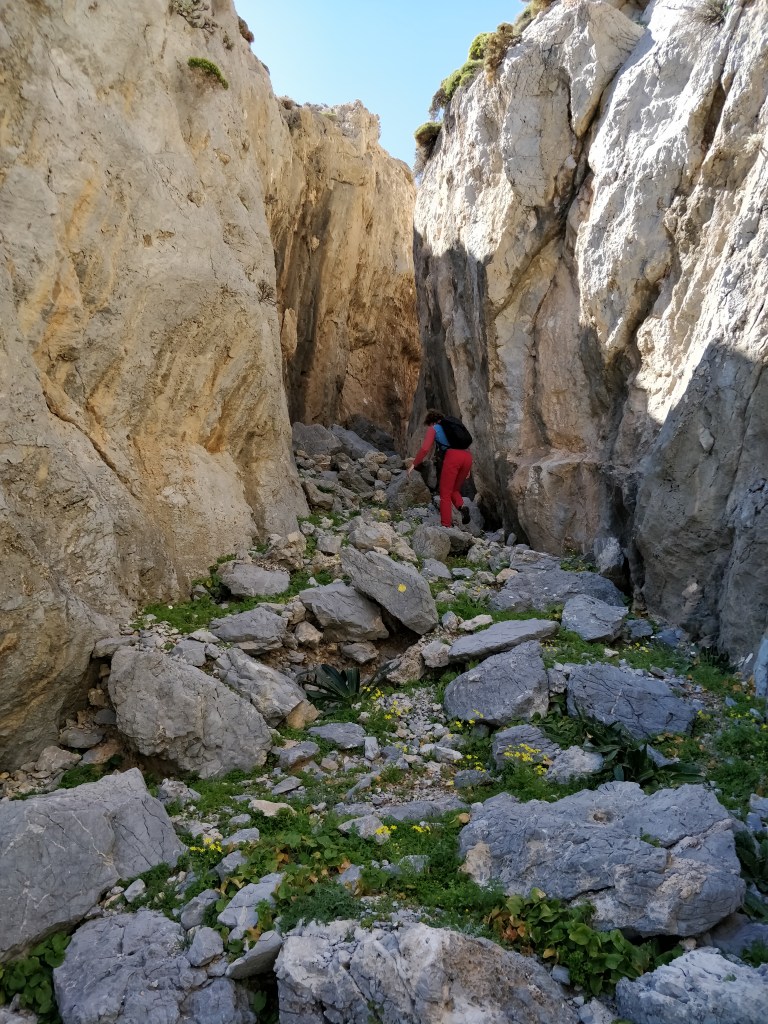
Heading into Princess Canyon 
Jon admiring the canyon walls
We were diligent about following the yellow dots! That was until we started having a conversation, and then we realised that we hadn’t seen a yellow dot for a while. We had lost the trail and didn’t know if it was higher or lower than we currently were. At this point Jon mentions that the trail is marked on an App on his phone (I had been trying Google Maps but it wasn’t marked on there). So we got that out, and sure enough there was the path, and the dot marking our location was offset. We needed to be higher. So we trudged back up the hillside and ten minutes later we were back in contact with yellow dots. I was greatly relieved. My stress levels had spiked considerably when I realised we had gone off route again. We stopped talking and focussed only on yellow dots.
The path was sometimes clear but regularly no more defined than any other goat route along the hillside. At one point it took us into a giant boulder field, chunks of rock up to five metres high and many metres wide thrown on top of each other as they tumbled down the hillside. We followed the yellow dots over the boulders, trusting that they would deliver us to the other side along the most efficient path. And sure enough after ten minutes of boulder hopping we emerged back onto the vegetated hillside.
We continued to make good progress and before long we could see the familiar coves near the harbour, the end was in sight! But not before one final challenge. The yellow dots led us resolutely to the steep, scary, red scree slope we had seen and avoided at the start. The rocks were small, flat and incredibly loose. There was a noticeable path across the slope where it looked slightly more compact and we hesitantly started to traverse it. I glanced down at the waves hitting the base of the slope, nothing but unstable scree between the sea and me. I focused back on the path and didn’t look down again. Fifty metres later and we were back on solid ground. I was getting a growing sense of having survived an environment that I was not meant to be in. A bit melodramatic perhaps, especially as this was part of a walkers trail, but the potential for catastrophe was apparent at almost every turn.

As we turned the final corner back through the goat gate a sense of relief washed over us, and we bounded down the small streets back to the harbour looking forward to a drink in the sunshine with Mark and Penny while we waited for the final boat back. It was nearly 4pm and we had been out walking for 6 hours.
But Mark and Penny were not there.
We looked up and down the harbour front but there was no sign of them. We called their phone but it went straight to voice mail. We even looked at the nearby ruins but they were not there. After 10 minutes of searching we were getting worried. It had taken us 1.5 hours to get back from Princess Canyon, and they should have had at least a 45 minute head start on us. I remembered that treacherous scree slope and my focus solely on the path in front. I had visions of them waving to us for help from the bottom of the slope, their voices muffled by the sound of the sea and the screeching gulls. Or had something happened in the boulder field? Were they injured somewhere and couldn’t get out?
The penultimate ferry was approaching the harbour as we started to confer on what to do next. Something caught my eye and I glanced up and saw Mark running towards us, alone. Shit.
“Where’s Penny?” I asked anxiously.
“She’s back at the gate, I ran to make sure we didn’t miss the last ferry.”
Sure enough Penny appeared a few seconds later, both of them looked stressed and exhausted.
“Don’t panic, that is not the last ferry!” I replied.
We decided to catch it anyway and get home quickly, their adrenaline levels needed time to come down before they could relax. On the ferry we found out what had happened.
They had lost the path shortly after we left them and never managed to find it again. Taking what we surmised to be a higher route than Jon and I, they had to find their own path across the boulder field with no idea how stable it was, or whether they should be in it or not. It took them over an hour to traverse the boulders. “I was more scared than I have ever been in the mountains” Mark commented as his face slowly began to relax. The panicked run at the end was due to mis-reading the time, and thinking the ferry that was just arriving was the last one back. What should have been a relatively straight forward day walking had turned into a bit of an epic for them.
We returned to our apartment, physically tired and emotionally drained. Sitting on the comfortable sofa’s we allowed the restorative nature of tea to take effect.
If you would like our blogs delivered directly to your inbox, just enter your email address at the top of the page on the right hand side.

Oooft!!!
Compelling reading! I’m happy you all survived ok…. The south side is a bit special, and the walk around the island can be daunting, ask my sister!!!
I also enjoyed reading the Kalymnos overview. Its interesting and I would say that while on the one hand, you had the island to yourselves, very peaceful, with few other climbers around, on the other it was pretty wet, narrowing your route options and perhaps the enjoyment of some of the climbs you could get done, and of course, Masouri was still closed for winter. So when people choose to come can definitely colour the impression they leave with, as you can now appreciate. Timing is key isn’t it, and it explains why autumn is SO busy compared to early Spring.
Keep blogging 🙂
Mike
LikeLiked by 1 person
Hi Mike,
I completely agree. It was fantastic to have so many sectors to ourselves, but the price we paid for that was unsettled weather and closed cafes! That said, we would probably return at the same time of year if we come again, perhaps a week or two later.
Gaynor
LikeLike
I walked to the summit using paths marked on the OS Map app. It was slow going, as you describe, rocky, lots of gorse and route finding requires great care.
LikeLike